
City of Richmond
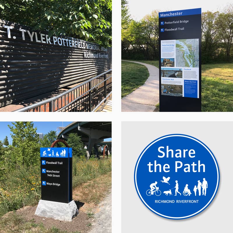
T. Tyler Potterfield Memorial Bridge
Richmond, Virginia
Since the turn of the 21st century, residents and visitors alike have fully embraced the downtown riverfront of Richmond for its natural beauty, historic industrial infrastructure and sweeping vistas of the downtown and Manchester skylines. A riverfront focal point is Brown’s Island, a public park with venues for recreational and cultural activities as well as passive open green spaces. The Richmond Riverfront Plan, adopted by Richmond City Council in 2012 as a part of the City's Master Plan and Downtown Plan, is the City’s vision document for the Riverfront. The T. Tyler Potterfield Memorial Bridge was selected as the first major development initiative of the plan. The new 1,600’ bridge sits atop a former 1901 hydroelectric dam, some 20 feet above the river. The bridge was designed to create a safe and attractive shared-use path across the river connecting Brown’s Island on the north side of the river to the community of Manchester, an independent City until 1910, on the south side. Retaining as much of the existing historic dam structure below as possible the new metal deck and railings provides a safe surface for users to walk, run, ride a bike, and travel in a wheelchair across the river. Completed in 2016 at the cost of $11.3 million, it was named for the late City of Richmond senior planner T. Tyler Potterfield. The bridge provides unequaled river vistas, panoramic views of the downtown skyline, along with sounds that belie the extraordinarily close relationship of the bridge to the roaring river. The wheelchair accessible bridge is open to pedestrians and cyclists 24 hours a day. The structure opens one of the most beautiful sections of the James River to cyclists, pedestrians, and the disabled. For more information, visit www.jamesriverpark.org.
Working in collaboration with the City of Richmond Department of Planning and Development, the James River Parks System, and Hargreaves Associates (the bridge designers), 1717 Design designed and administered the installation of a family of identification, orientation, wayfinding, & interpretive signage for the new bridge and adjacent properties.